





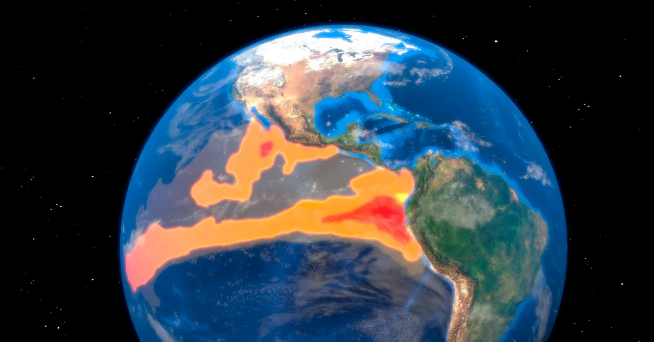
El Niño, a recurring climate pattern in the tropical Pacific Ocean, is a significant and increasingly impactful event with far-reaching consequences for weather patterns, water resources, and global economies. It’s a complex phenomenon that’s been observed for centuries, but its recent intensification has spurred heightened concern and research. Characterized by unusually warm waters in the equatorial Pacific, El Niño occurs every few years, triggering a cascade of effects across the globe.
Meteorological agencies, including the National Oceanic and Atmospheric Administration (NOAA) in the United States, continuously monitor sea surface temperatures in the Pacific. Specifically, a region known as NINO3.4 – a defined area between NINO3 and NINO4 – is the primary focus for determining whether an El Niño is occurring. The threshold for an El Niño is typically defined by a 0.5-degree Celsius (0.9-degree Fahrenheit) increase in sea surface temperature over three consecutive three-month periods, which is a significant measurement.
The US National Oceanic and Atmospheric Administration (NOAA) uses this data to determine if an El Niño is in effect, and Japan’s Meteorological Agency similarly monitors its own criteria. Furthermore, the weakening of trade winds, a key component of the El Niño cycle, plays a crucial role. In 1997 and 2015, sea levels rose over 18 centimeters (7 inches) above average, largely due to the increased influx of warm water from the Pacific.
Beyond the warmer waters, the trade winds that blow from east to westr weaken, allowing seawater to pile up on the eastern side of the Pacific. In 1997 and 2015, this resulted in a significant increase in rainfall in the Southwest, exceeding the average, and Lake Mead’s water levels reached near-capacity, causing water to overflow from the Hoover Dam spillway for the first time in about 40 years. This surge in water has had significant impacts on water resources and infrastructure.
The economic implications are substantial. An analysis by Berkeley Earth estimates that the 1997–98 El Niño resulted in a cumulative loss of approximately $5.7 trillion over the following five years, impacting the Colorado River basin in the US, while the 2023-24 super El Niño contributed to the worst drought in over 100 years for southern Africa.
This year’s El Niño is predicted to be ‘very strong’ according to NOAA, with temperatures potentially reaching 3.6 degrees Celsius above average – exceeding the all-time high recorded during the 2015–16 El Niño by approximately 0.8 degrees Celsius. Modeling by the same group shows that median temperatures for the NINO3.4 region could reach 3.6 degrees Celsius above normal, even after accounting for the effects of long-term global warming. This represents a significant and rapid increase in warming.
It’s important to note that El Niño is not the only factor influencing weather patterns; other phenomena, like La Niña, also play a role. La Niña typically brings higher odds of more rain in Indonesia and a more active Atlantic hurricane season, while drier conditions in the Southwest. However, the overall trend points towards a more intense El Niño event this fall and winter, a period that’s currently being monitored closely.
This story originally appeared in WIRED Japan and has been translated from Japanese.
Watch Related Video
Source: Wired Science